Himachal Pradesh Travel Guide
---------------------------------------------------------------------------------------------------------------------------------------------------------------------------------------------------------------------------------
Himachal Pradesh Home » About Himachal Pradesh » Places to See » Buddhist Pilgrimage Tours » Fairs & Festivals
Adventure Tourism » Air Line Ticketing » Car Coach Rentals In Himachal Pradesh
Hotels in Himachal Pradesh » Map »Travellers Tools
---------------------------------------------------------------------------------------------------------------------------------------------------------------------------------------------------------------------------------
Adventure Tourism
 The
state of Himachal Pradesh is made up of ten districts with a total area of
56,019 sq km. The northern border of Himachal Pradesh is bounded by Tibet,
in the north-west it borders Kashmir, in the south lie the plains of Punjab
and the eastern border is common with the hills of Uttar Pradesh. The state
is rugged and mountainous, and the valleys of Lahaul and Spiti are the dream
of mountaineers.
 Lahaul and Spiti is a desolate region in comparison to the lush Beas valley of Kullu, also a popular mountain area of the state. Spiti, which overlooks Tibet across the Sutlej river, is Tibetan in landscape and in the character of its few inhabitants. Kullu and Lahaul are good areas for mountaineers practising both alpine style ascents and ski-mountaineering. The jagged ice peaks of Kullu offer good routes for the 'tiger' as well as the less ambitious mountaineer. A popular peak in this area is Deo Tibba (6,001 m) which is visible from Shimla, the capital of Himachal Pradesh, and Indrasan (6,221 m), a challenging peak of steep red granite which can be climbed from four different routes.
The Menthosa snowpeak in Chamba at 6,445 m has never been totally conquered, nor has Dharmasura (6,446 m) in the Bara Shigri glacier region, though they provide opportunity for some excellent mountaineering.
A close cluster of the M&KR series in the Milang river basin has more than a dozen peaks over 6,000 m high worthy of the hardiest ridge runners. Himachal may well hold the track record for peaks that have defied a first time ascent. For example, the Chandra Bhaga watershed and the Parvati valley have several over 6,000 m peaks, most still unclimbed.
Winter Sports:
Narkanda lies forty miles north of Shimla on Kipling's famous Hindustan-Tibet road at a height of nearly 9000 ft. The nearby peak, Hathu, dominates the great watershed of India, for from here you can see both the Sultej and the Giri which flow into the Indus and Ganges systems respectively.
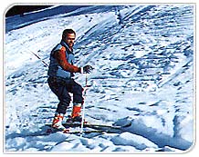
The skiing season in Narkanda starts in January and lasts into the first week of April. While you may have six to ten feet of snow, the motor road to Shimla usually remains open and this makes Narkanda a very convenient destination from the cities of north India.
The slopes will appeal to the cross country skier for Narkanda is set amidst fine conifer forests. A short distance to the west of a PWD bungalow are the beginners' slopes in a clearing and a tow bar (or T-bar) has also been installed. The Hathu slopes on the east delight those who want to get away from it all, and it is possible to
 ski
down towards the famous Stokes (the apple kings of India) country at Kotgarh.
The government-run classes provide their own equipment. The beauty of Narkanda
is that being only an over-night's journey from Delhi one can fit in a skiing
weekend at rates easily the lowest in the world and against a backdrop of
the finest forest and mountain scenery. While Narkanda is quite developed,
skiing at Kufri is still taking off, and has the advantage of proximity to
the plains. The Manali region offers scope for both winter as well as summer
skiing.
ski
down towards the famous Stokes (the apple kings of India) country at Kotgarh.
The government-run classes provide their own equipment. The beauty of Narkanda
is that being only an over-night's journey from Delhi one can fit in a skiing
weekend at rates easily the lowest in the world and against a backdrop of
the finest forest and mountain scenery. While Narkanda is quite developed,
skiing at Kufri is still taking off, and has the advantage of proximity to
the plains. The Manali region offers scope for both winter as well as summer
skiing. When the snows herald in winter, the area around Solang Nala attracts skiers to its extensive natural slopes. In the summer months, there are limited skiing possibilities on the slopes of the Rohtang Pass. The government-run classes provide their own centre with a natural open-air ice-skating rink. Under Scandal Point on the north side of the ridge facing the Dhauladhar are Blessington's tennis courts which become, in the months of December and January, Shimla's Ice Rink. The Shimla Club is privately run and has been instrumental in popularising all three disciplines on ice for more than twenty years: figure skating, ice hockey and speed skating. Boots are made to measure in Shimla itself. Seasonal membership is inexpensive and national championships are held annually.
It is in Garhwal Himalaya mountains that the infant holy Ganga finds its source. The Garhwal Himalayas stretch just over 290 km and are separated from the Punjab Himalayas by the river Sutlej. Garhwal was the first part of the Himalayas to be explored and surveyed, and the highest peak in these mountains is less than 8,000 metres. Garhwal is flanked by Tibet in the north, Kumaon in the east, Bijnor in the south and Tehri and Dehra Dun in the west.
Nanda Devi, also called the 'pearl of the Himalayas' is the highest peak in the Garhwal mountains. Nanda Devi has twin peaks, the main peak and the east peak. The main peak was climbed in 1936 by H.W. Tilman andN.E. Odell while the east peak was scaled in 1939 by a Polish team. Nanda Devi is revered since ancient times and worshipped as the Goddess Nanda. T.G. Longstaff, one of the earliest explorers of the Garhwal region has described the holy mountain as: "No mountain in the world is more beautiful than Nanda Devi."
Another popular peak in the Garhwal region is Kamet. Ten expeditions attempted this peak before it was finally scaled in 1931 by a team led by Frank. S. Smythe.
At the traditional source of the Ganges one can find the best mountaineering area probably in the world. A few kilometres above the ice cave from which the river takes birth are the meadows of Tapovan and Nandanvan, spread at the base of the most magnificent panorama of peaks you will ever see. The peaks are mainly over the 20,000 ft mark and still have unclimbed faces offering alpine style ascents. Mount Shivling has often been compared to the Matterhorn. All along the 30 km length of the Gangotri glacier are side glaciers, some not yet fully explored. One can also traverse to the southern face of the crest which provides steeper ice faces.
In the far west of Garhwal, Har-ki-Dun provides a spectacularly beautiful base for attempts on the Bandar Poonch group and the approach along the Tons valley is one of the last unspoiled areas of the Himalayas. Eastwards, now that the Nanda Devi Sanctuary cirque has been closed, climbers have to approach Trishul by the more formidable south face. This involves a ten day trek up the Mandakini valley through impenetrable birch and bamboo jungle to reach base.

Further eastwards, Kumaon provides the fairly easy access to the Sunder-dhunga glacier, but the outer curtain of Nanda Devi's cirque beetles over the proceedings defying, so far, any attempt to climb into her sanctuary from the south. The jagged five Panch Chuli peaks still require special permission for scaling.
Winter Sports (Garhwal Himalaya):
Joshimath, traditionally a pilgrim town, is now being developed as a skiing resort for Garhwal. A ropeway is under construction to take visitors from the town at 6,000 ft to the slopes of Auli and Gorsain near the Kuari Pass at 12,000 ft. The panorama of Himalayan snow peaks from Kuari is perhaps the most spellbinding in the world.
The bonus for winter visitors to Joshimath is the weather, for in three months (January through March) of the skiing season there are no clouds as there are at most times of the year. The clear blue sky and the surrounding snow giants make this the ultimate ski resort in the making.
Add to this the fact that Auli and Gorsain are actually looking down the legendary Rishi gorge which holds the key to entering the mysterious Nan-da Devi Sanctuary and have the best view of the great goddess as she soars cleanly out of the encircling ring of ice. Here is skiing to a background of the most sublime mountain music.
Himachal Pradesh Home
» About Himachal Pradesh
» Places
to See » Buddhist
Pilgrimage Tours » Fairs
& Festivals
Adventure Tourism » Air Line Ticketing » Car Coach Rentals In Himachal Pradesh
Hotels in Himachal Pradesh » Map »Travellers Tools
Adventure Tourism » Air Line Ticketing » Car Coach Rentals In Himachal Pradesh
Hotels in Himachal Pradesh » Map »Travellers Tools